ART3MIS-AI
Augmented Real-Time 3D Mapping with Integrated Sensing Artificial Intelligence
What does ART3MIS-AI do?
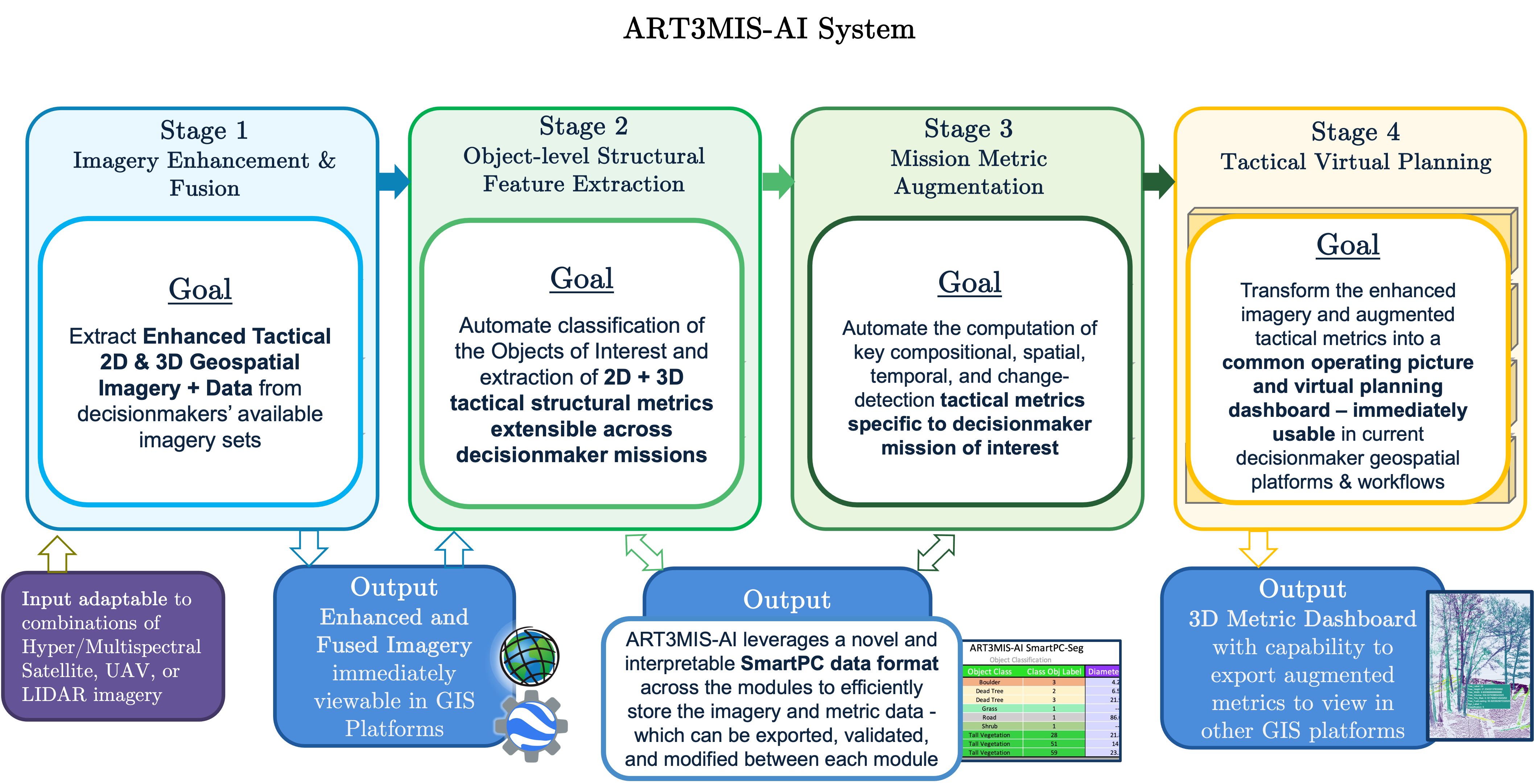
- Transfers geospatial AI research capabilities into stakeholder missions adapting to stakeholder sensing constraints and existing geospatial workflows
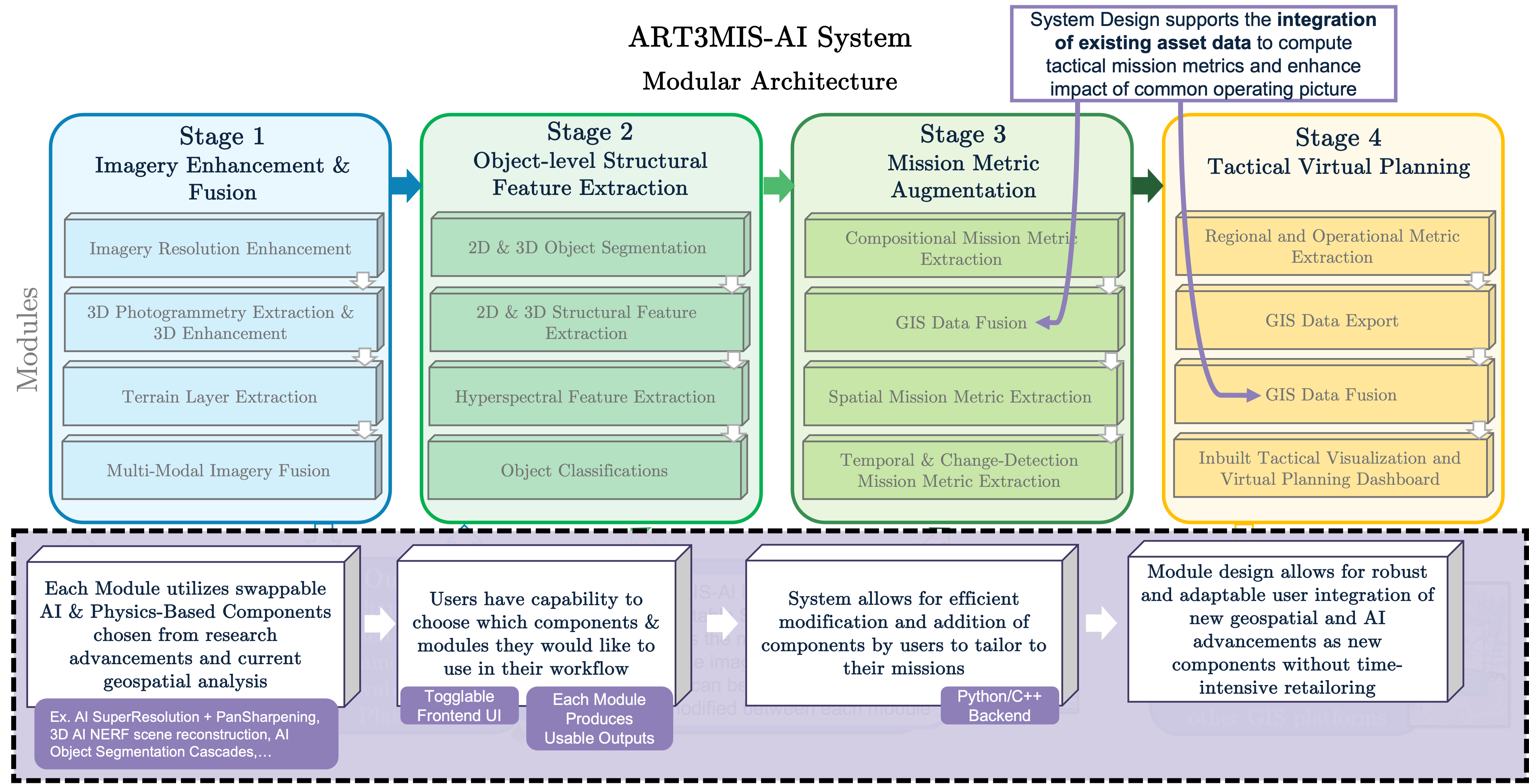
- Links multiple geospatial & AI research capabilities and advancements as modules to automate the enhancement, fusion, and extraction of key structural metrics with object detection from multi-modal imagery sources
- Rapidly & autonomously extracts and transforms structural features to extract mission critical 2D & 3D features, metrics, and representations, accelerating the rate of actionable information to decisionmakers
- Outputs the AI-augmented imagery & metrics in accessible format for easy decisionmaker tactical visualizations and extensible use across missions
Why ART3MIS-AI?
- Backend software accessible and interpretable through modular python/C++ design, Frontend integrates with existing GIS platforms
- Adaptable to available inputs, ex: hyper/multispectral satellite imagery, Unmanned Aerial Vehicle (UAV) imagery, or LiDAR
- Modular system design allows users to use, modify, and add relevant tailored components to the pipeline – This may translate to using initial modules for improving satellite imagery resolution, or using full pipeline to extract point clouds with embedded metrics

