ART3MIS-AI Prototype Demo
Application: Tactical Forestry Remote Sensing & Wildfire MitigationART3MIS-AI to Support Forestry Mitigation Managers & Deployment
In 2022, natural disasters cost the U.S. $165 billion, with wildfires burning over 7.5 million acres. Remote Sensing (RS) technologies are critical to close the widening gap between the area coverage necessary and physical personnel limitations. However, forestry RS deployments lack capture of key vertical structure and classification metrics necessary for responsive decision support in mitigation fuel mapping, risk analysis, and virtual planning.
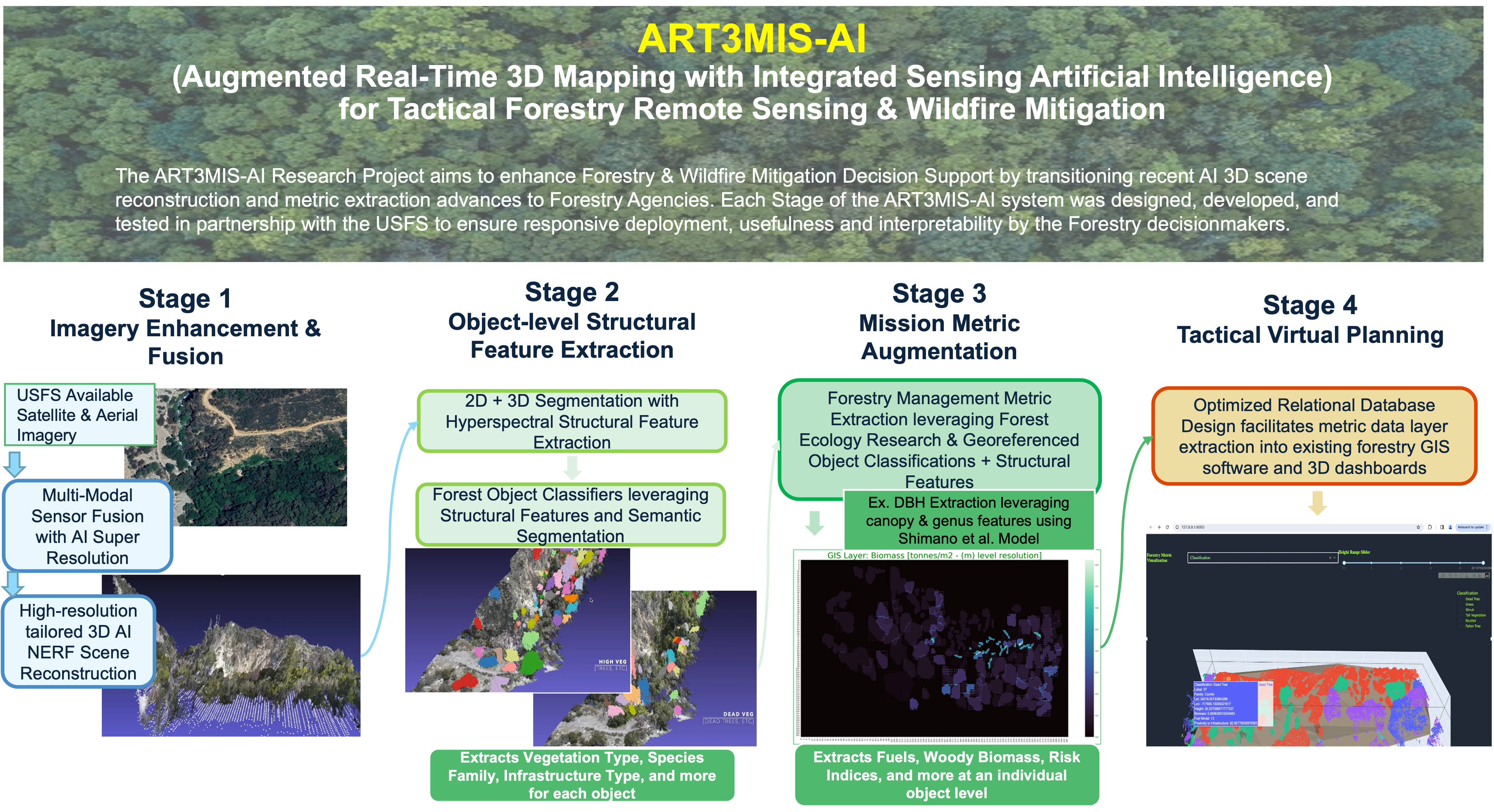
The ART3MIS-AI leverages forestry RS research advances within a novel AI cascade for a cost-efficient rapid response solution architected for agency infrastructure integration. With adaptable multi-modal sensing input, ART3MIS-AI utilizes a four-stage pipeline to extract ‘Smart’ georeferenced point clouds with fused augmented hyperspectral information, vegetation & species classification, and structural/high-value mission metrics to an individual tree scale (crown and bolar metrics, fuel loading and biomass, timber metrics, proximity risk to critical infrastructure, etc.)
ART3MIS-AI’s 4-Stage Tactical Utility in Forestry Missions
Stage 1: Enhance Imagery
Leverage AI & photogrammetry to extract enhanced 2D imagery & high-quality point clouds from satellite/UAV imagery
Stage 2: Extract Metrics and Features
Leverage AI object detection & classification to automate species identification and extraction of vegetation structural features
Stage 3: Wildfire Mitigation Missions
Compute fuel & biomass values for each vegetation object and leverage previous structural features & smart database design to automatically extract fire risk estimates – can be swapped with other forestry missions
Stage 4: Visualization Dashboard
System design provides both high-resolution 2D and 3D output integration in existing visualization software with user manipulation and operability

